

This 8-mile circular walk captures all that is best around the Ashridge Estate. From ancient beech woodland and bluebell-carpeted forest floors to the views from Ivinghoe Beacon. It even stops in medieval Aldbury for a pub lunch and a pint.
The Chilterns have no shortage of fine walking country, but this circular route from Ashridge Estate via Ivinghoe Beacon to the village of Aldbury is one of the best.
In the space of eight miles, the walk moves through ancient beech woodland and bluebell-carpeted forest floors. It crosses open chalk downland with sweeping views toward Oxfordshire, climbs to an Iron Age hillfort that has watched over the valley for three thousand years, and descends into one of the most unspoiled villages in Hertfordshire.
What we love is the variety. There is a real sense of moving through different landscapes — the cool shade of Ashridge Forest giving way to the exposed ridge of Ivinghoe Beacon, the drama of the chalk downland softening into the quiet charm of Aldbury’s duck pond and medieval stocks.
The walk is 8 miles (12.9km) and takes around three hours and forty-five minutes at a steady pace, or a full day if you stop for lunch in Aldbury.
We have graded it medium difficulty, with around 920 feet of ascent. The post includes a map, directions, and recommendations for where to eat and drink along the way.
It is one of our favourite walks near London, and a highlight of our Country Walks near London series.
Ivinghoe Beacon & Ashridge Estate Walk Overview
- Start / End: Ashridge Estate Bridgewater Monument
- Distance: 8 miles (12.9 kilometres)
- Walking Time: 3 hours, 45 minutes
- Elevation: 920 feet ascent & descent
- Difficulty: Medium
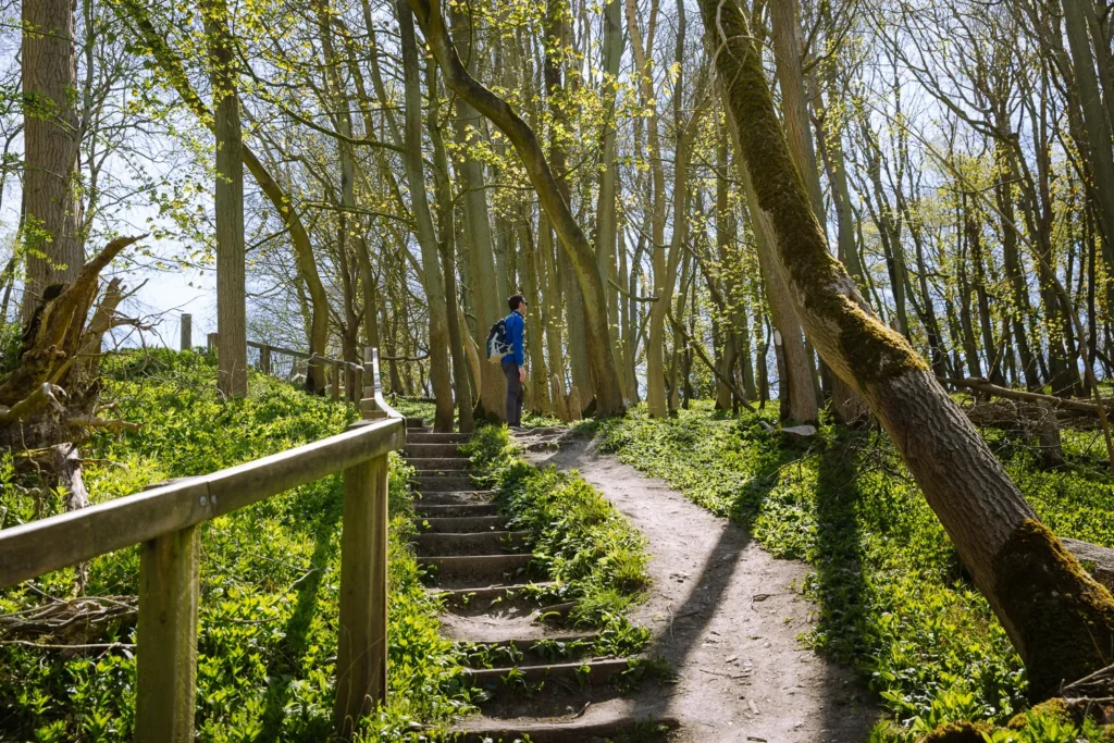
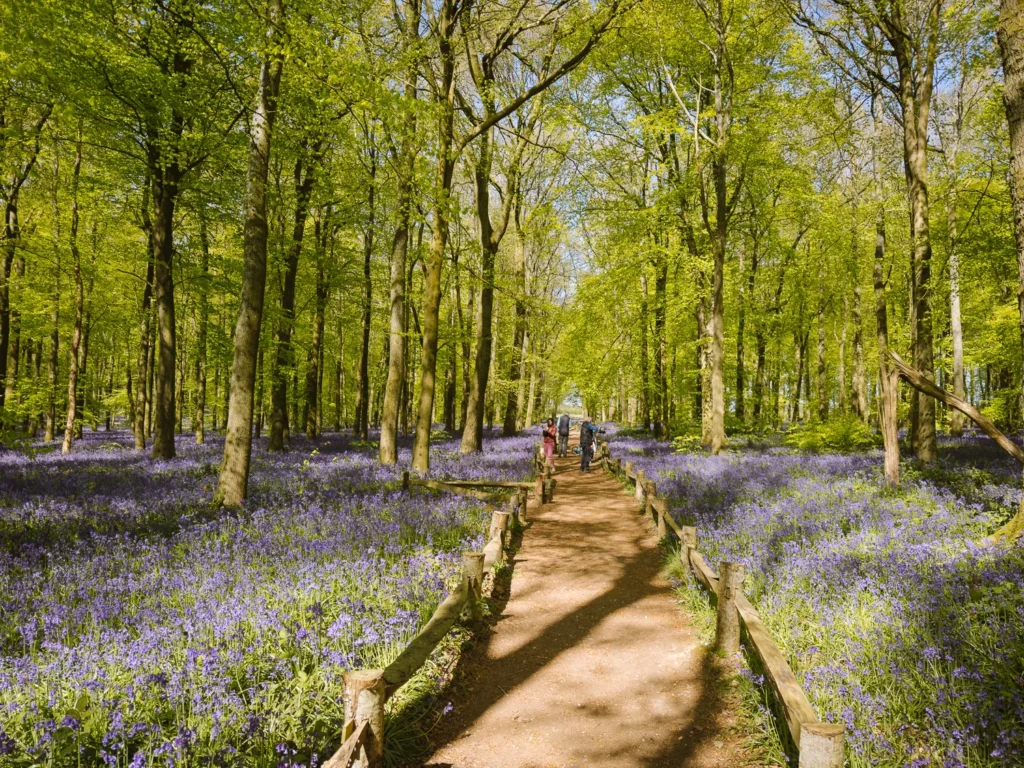
This 8-mile circular walk begins in the Ashridge Estate and heads through beech woodland. A short detour brings you to Dockey Wood, home to one of the finest bluebell displays in the country from mid-April to mid-May.
It then exits the trees and climbs onto a wide open ridge to reach Ivinghoe Beacon, one of the great viewpoints in southeast England.
From here, it follows the Ridgeway National Trail, switching between chalk uplands and gently lit ancient woodland, before descending into the Domesday-listed village of Aldbury.
Regularly used as a film set, it’s got a couple of great pubs and cafes for lunch. From there, it’s a short climb back through the trees to the Ashridge Estate where you started.
There is nothing particularly challenging on the walk, although the path undulates with just over 900 feet of ascent and descent.
The route is a mix of earth and gravel tracks and can be muddy after rain — waterproof boots or shoes are recommended. The route is dog-friendly, as are the pubs.
Map: Ivinghoe Beacon & Ashridge Estate Walk
The map below shows the route of the walk. We have marked the nearest car parks and train station, as well as the best places to stop for lunch or a drink.
Open the map on your phone to follow your progress as you walk.
For a more detailed map, including elevation changes and mountain contours, use this OS Map.
When to Do the Walk
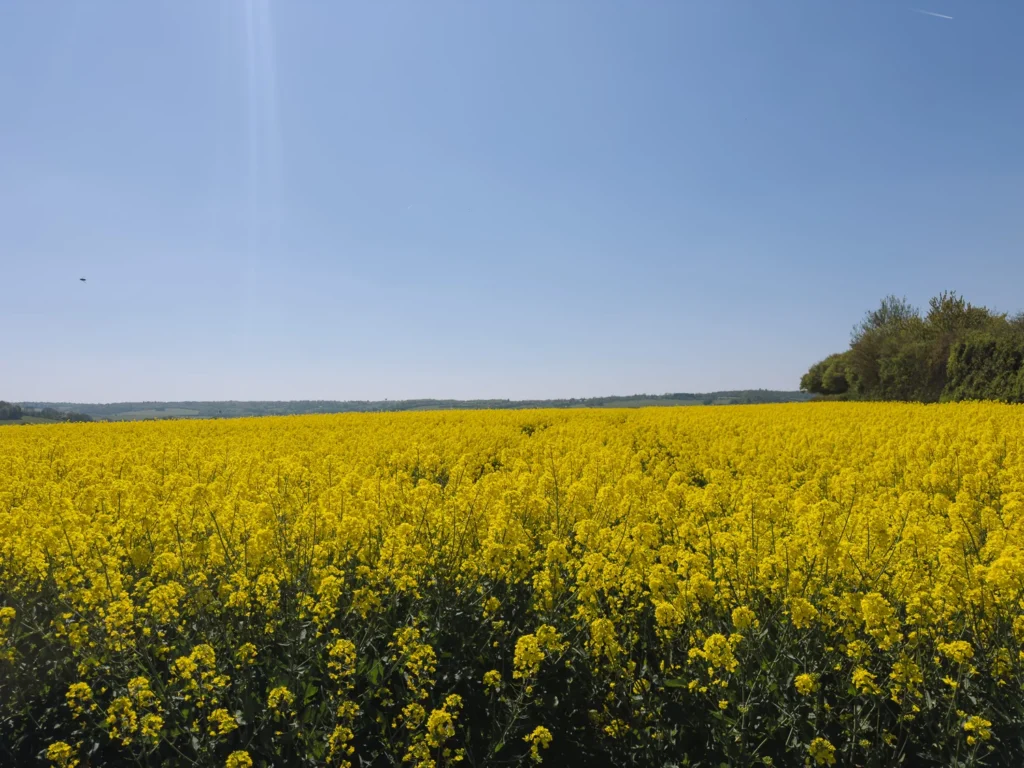
This walk can be done any time of year, but our favourite time is from mid-April to mid-May when the floor of Dockey Wood is covered in bluebells, and yellow-flowered rapeseed stretches across the fields. Together they provide a wealth of beautiful colour.
Pick a clear sunny day and the views from Ivinghoe Beacon are wonderful.
The walk is mainly along earthen or gravel tracks. Try to avoid walking after heavy rain as the path, especially along the Ridgeway, can be muddy.
Where to Eat & Drink
There are loads of places on this walk to have a picnic. Our favourite picnic spots are on Ivinghoe Beacon or Pitstone Hill. But there are also options for a more substantial meal.
There is a National Trust Cafe at the beginning/end of the walk. However, the best options are the pubs and cafes in the village of Aldbury.
Here are your options, in the order you’ll reach them on the route.
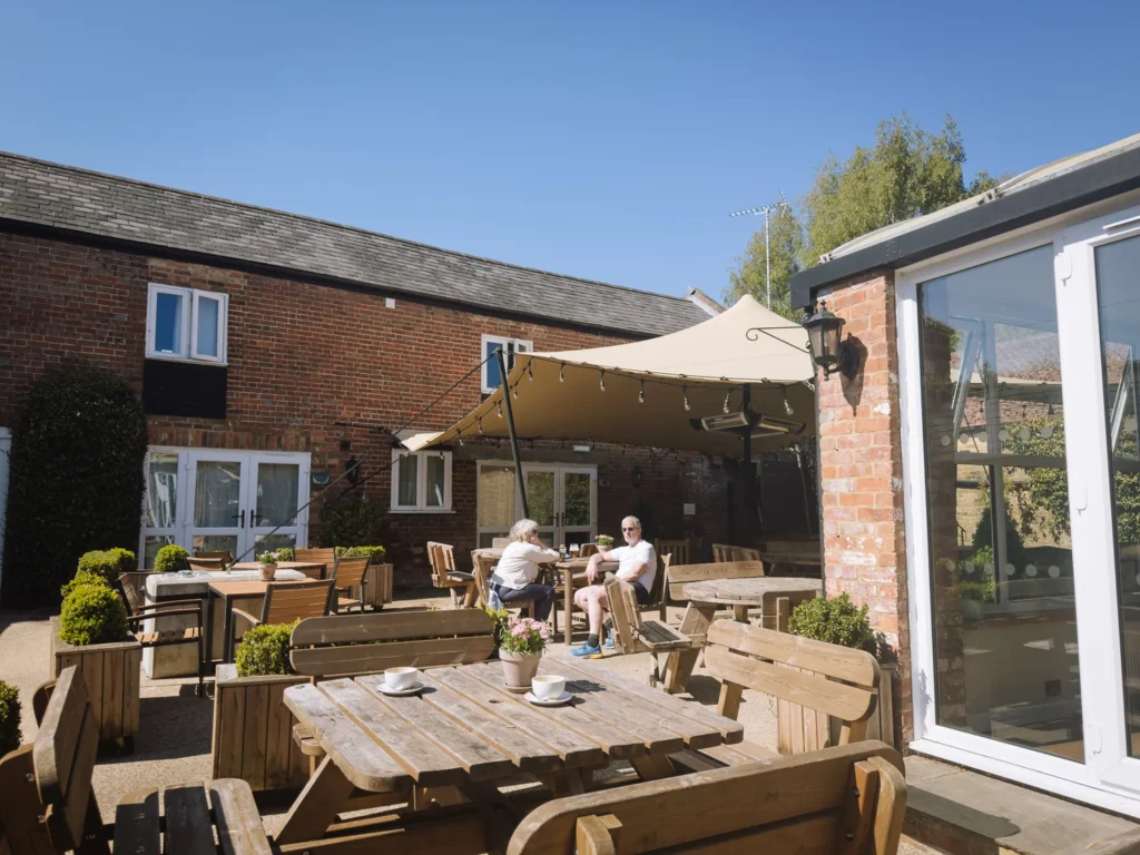
Ashridge Monument National Trust Cafe is right next to the National Trust Ashridge Estate Car Park, where this walk begins and ends. There are better places for lunch, but it’s a good option for a caffeine fix before setting off.
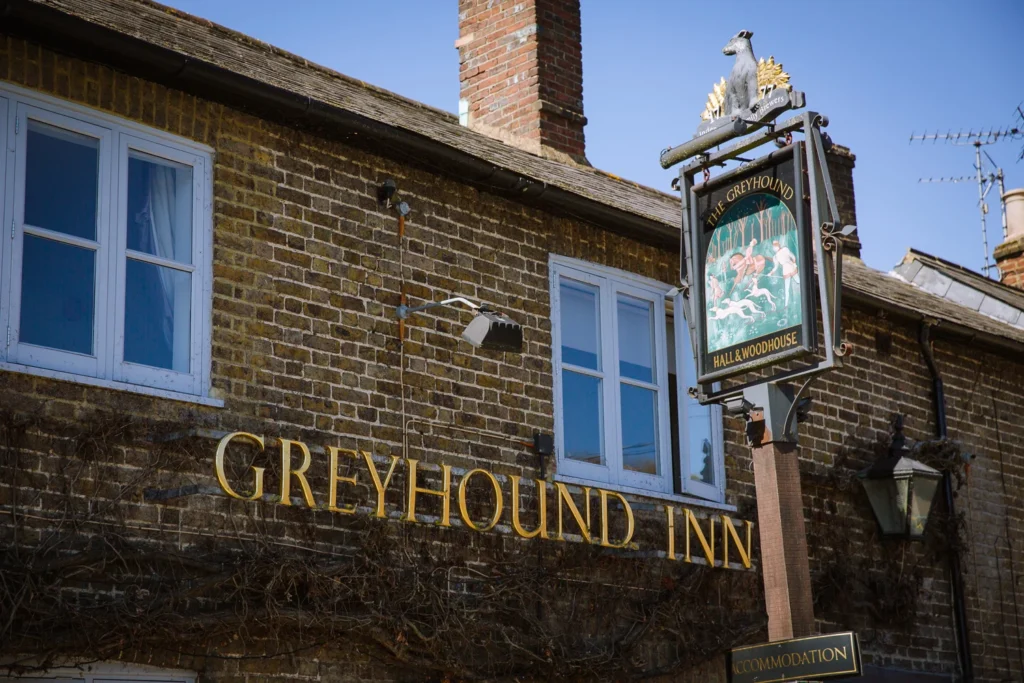
The Greyhound in Aldbury (dog-friendly) is where we head for a pub lunch whenever we do this walk. You can just turn up midweek, but on weekends we suggest booking in advance. Make your reservation for about 3 hours after you plan on starting the walk (assuming you start at Ashridge Estate and walk anti-clockwise).
The Trooper is a more upmarket pub, also in Aldbury. We have not eaten here, but it always looks nice and was listed in the Good Food Guide – Top 100 Local Restaurants 2024.
Poppies Cafe is a bright and friendly cafe in Aldbury. It serves sausage rolls, soups, full English breakfasts, and more. Only open Friday to Monday.
Getting to the Walk
Ivinghoe Beacon and Ashridge Estate are at the northern end of the Chilterns, 23 miles northwest of central London. This circular walk can be reached by car or train.
By Car
The walk described below assumes you have arrived by car and parked at Ashridge Estate National Trust Car Park (HP4 1LX). There are loads of spaces, and parking is free, even if you are not a member. There are toilets and a cafe right next to the car park.
If you walk anti-clockwise, the pubs in the village of Aldbury are about 3 hours in, after you have completed 90% of the walk.
If you would rather have the pub about halfway through the walk, park at Pitstone Car Park (HP23 5RT) and start from there.
By Train
Tring Station is the most convenient station to join this walk. Regular direct trains run from London Euston (40 minutes) and Milton Keynes (22 minutes).
From Tring Station, it is a half-mile walk to connect with the circular walk (see the blue line on the map above). Add 1 mile (now 9 miles) and 30 minutes (now 4 hours, 15 minutes) to the total distance and time.
If you plan on eating in the pub in Aldbury, you may want to walk clockwise rather than anti-clockwise, so that it is near the end of the walk rather than at the beginning.
Ivinghoe Beacon & Ashridge Estate Walking Route
Ashridge Estate to Ward’s Hurst Farm
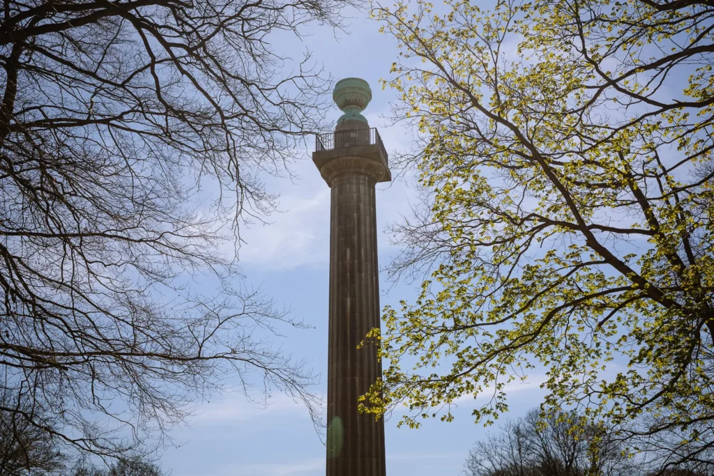
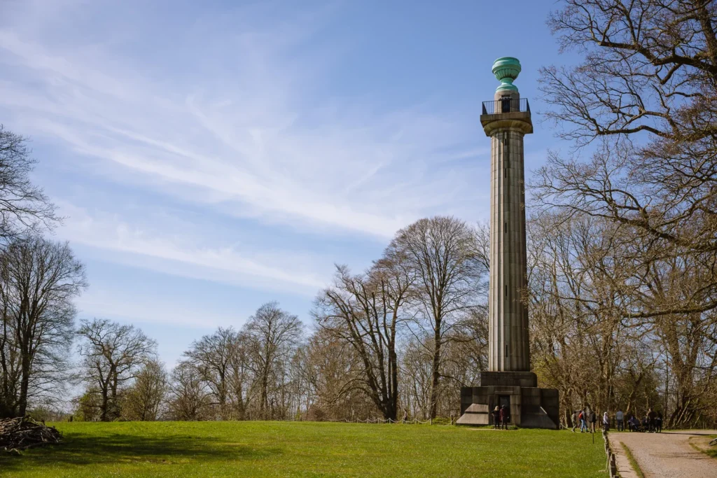
The walk starts at the Ashridge Estate Bridgewater Monument next to the National Trust Ashridge Estate Main Car Park.
Ashridge Estate encompasses 5,000 acres of woodland, commons and chalk downland, and a history to match its scale. Elizabeth I spent eight years here as a princess, the landscape was shaped by Capability Brown, and the grand Gothic Revival house that stands today is now a Grade I listed building.
From the monument, head north along a clear trail into the thick forest. Continue along the main path (ignoring the smaller paths leaving the trail).
After about 20-minutes, you will reach (2) on the map.
If it is between mid-April and mid-May, take the turn right and follow the purple path to Dockey Wood. During this time of year, the floor of the woods is often carpeted in bluebells.
We were there the first week in May, and it was a magnificent array of colour. There’s a short, easy square you can do around the wood before, walking along the road and cutting across to the Wards Farm (3 on the map).
If it is not mid-April to mid-May, continue on the main trail, then just after it bends left, turn right, and then right again. Cross over Beacon Road and walk between the fields to Ward’s Hurst Farm.
Ward’s Hurst Farm to Ivinghoe Beacon
Follow the signs through Ward’s Hurst Farm, and just after the marl pond, turn left through a wooden gate, following the public footpath sign. The route now heads into Ward’s Wood and descends steeply down some wooden steps.
Keep to the main trail, and as you reach the bottom of the hill, the deciduous forest gives way to conifers. Exiting the trees, keep right and cross through the middle of a chalk field.
Last time we were there, it was extremely white and bright, and we needed to put on our sunglasses. At the end of the field, turn left and follow the path up the hill, bending left again to reach Gallows Hill, where you have a great view over the ‘White Lion’.
Carved into the chalk hillside of the Dunstable Downs between 1931 and 1933, the White Lion is one of the largest hill figures in Britain, stretching over 147 metres from nose to tail.
From Gallows Hill, it is a short walk westwards to Ivinghoe Beacon (4 on the map).
Ivinghoe Beacon to Pitstone Hill
Standing at 249 metres above sea level, Ivinghoe Beacon is one of the great viewpoints in the southeast of England.
The hill is the site of an early Iron Age hillfort, and archaeological evidence has revealed human activity dating back to the Bronze Age. It has served as a warning beacon during conflicts as far back as the Spanish Armada in 1588, and later as a lookout point during the Second World War.
This is a great spot for a picnic with views across the Vale of Aylesbury and into Oxfordshire.
The beacon also marks the northern end of the Ridgeway National Trail. Considered to be the oldest road in Britain, this ancient trackway stretches 87 miles southwest toward Avebury. The next section of the walk follows this National Trail.
From Ivinghoe Beacon, head south along the white chalky trail. Cross over Beacon Road and stick to the main trail. Just past Steps Hill bend right, continuing to follow signs for The Ridgeway.
The trail now descends to Pitstone Hill Car Park. (Parking is free, and this is a good option if you want the pub in Aldbury halfway round). From the car park, the path climbs to Pitstone Hill (5 on the map), another good spot for a picnic.
Pitstone Hill to Aldbury
From Pitstone Hill, keep following The Ridgeway. The path enters some trees and meanders through the ancient woodland to reach a large junction of paths (6 on the map). Turn left, leaving The Ridgeway, and follow signs for Aldbury.
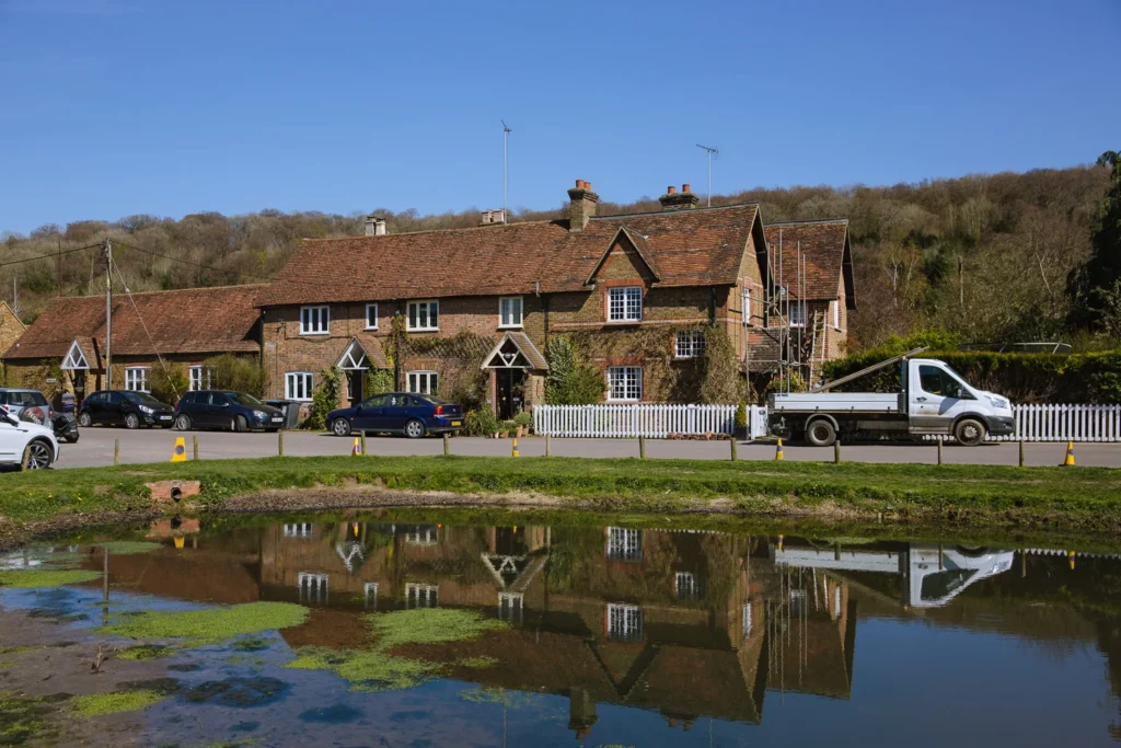
The trail exits the trees, passes through Stocks Golf Course – beware of bad golfers – and heads between two fields and through a gate to reach Station Road. Turn left on the road, and you’ll find yourself in the pretty village of Aldbury (7 on the map).
Aldbury is a lovely little place. Its manor was recorded in the Domesday Book of 1086, and the fields surrounding the village are essentially unaltered since the late medieval period.
Inside the village, timber-framed cottages and a historic inn cluster around the duck pond, where an old set of stocks still stand. It is so quintessentially English that it has been used as a filming location countless times, from Midsomer Murders to The Dirty Dozen.
It’s a highlight of the walk and a great spot for lunch or a pint.
Aldbury to Ashridge Estate
Take your time to wander around the small village.
We usually grab lunch at The Greyhound. Midweek, we have always been able to get in, but we have seen queues at weekends, so book in advance. They have a few small tables out front with a view over the pond, and a larger area to the rear.
You can also get lunch at more upmarket The Trooper, or grab some quick bites at Poppie’s Cafe (Friday to Monday).
Leave the village on Toms Hill Road heading east. Just past Poppies Cafe, keep left and join a gravel track, signed to Ashridge Monument. It enters the forest and steadily climbs up the hill.
15-minutes after you’ve left Aldbury, you are back at the Ashridge Bridgewater Monument, where the walk started.
Other Walks Near and in London
We have curated lots of walks like this.
To see our favourite country walks, read our Best Walks Near London.
For some urban walks, exploring the most interesting parts of the city, read our Best Walks in London.
We also have lots of ideas for days out from the capital in our Best Days Out from London. It covers university towns, medieval villages, seaside breaks, and lesser-visited gems.
More London Self-Guided Walking Guides

Anywhere We Roam is
reader-supported