

The Monte Popena circuit is the best way to explore the almost impenetrable Cristallo Group in the Dolomites. Here’s everything you need to know about this off-the-beaten-path trail in the Dolomites.
The Cristallo Group is a gigantic massif of nearly impenetrable rock. It is mostly a location for mountain climbers, as few hiking paths can traverse its steep sides.
However, Monte Popena, on its eastern flank, is accessible by two trails that have been cut across Cristallo’s high passes. Combining them into one circuit is an excellent way to explore the rocky landscape for which the Dolomites are known.
The hike only takes three hours, crosses two high passes, and visits a wonderfully remote valley.
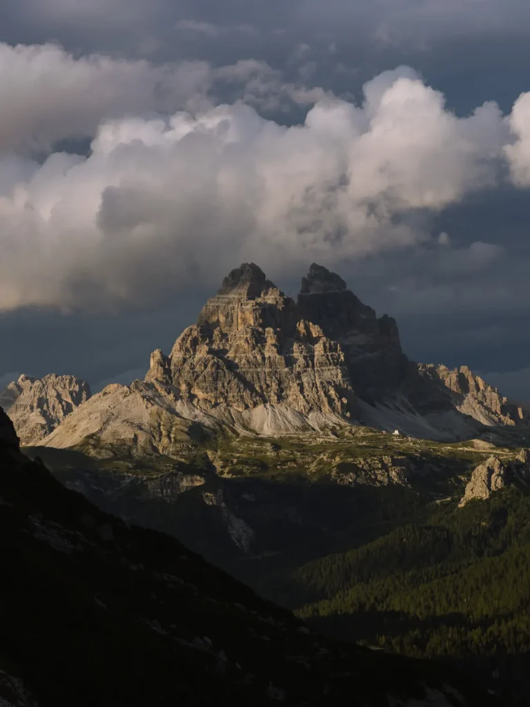
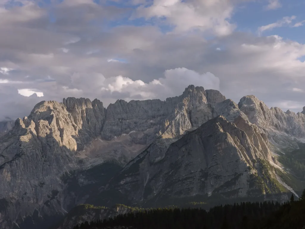
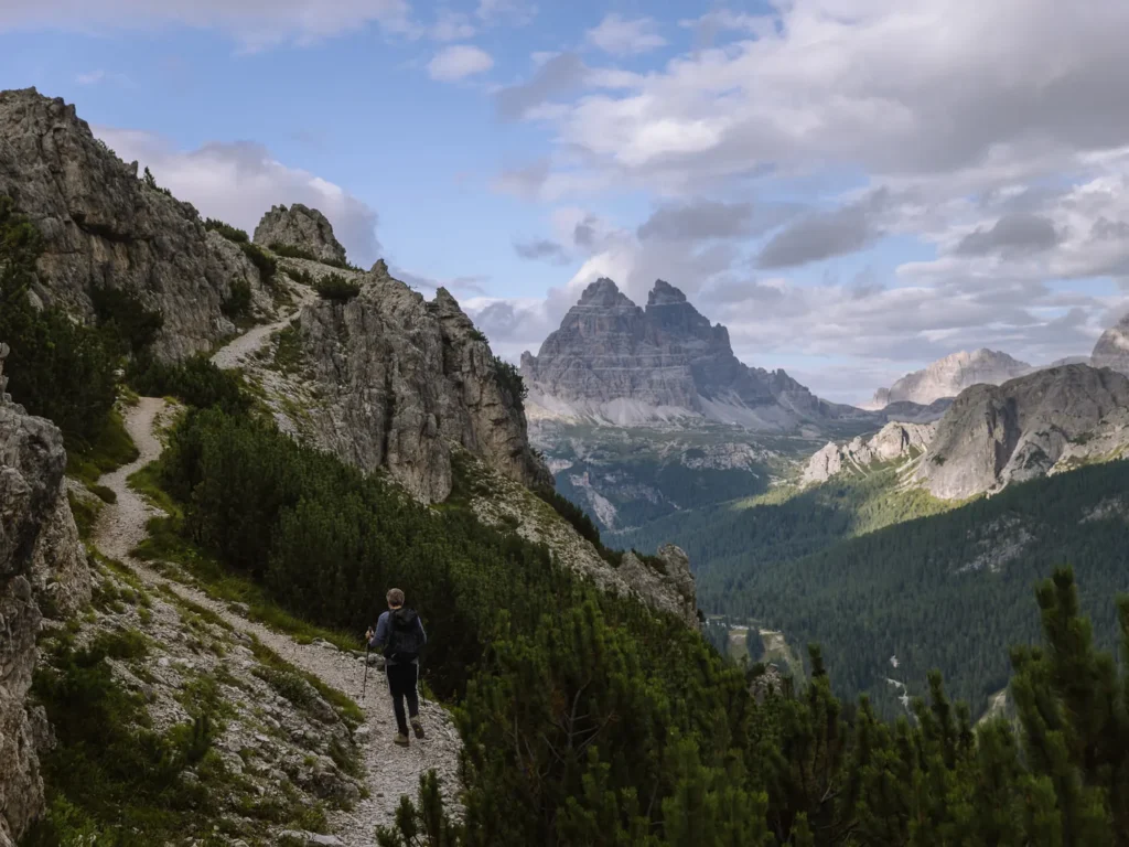
The views are excellent with Sorapis and Marmarole dominating the skyline to the south and Tre Cime soaring to the north.
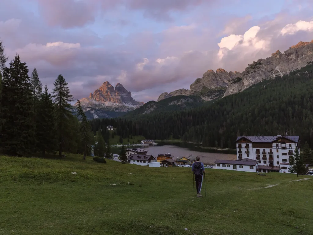
We completed the walk in August and barely saw anyone. We hiked in the late afternoon and were rewarded with a magnificent sunset on the descent, with a glow lighting up Tre Cime’s peaks. It was beautiful.
This post covers everything you need to know, including how to get to the trailhead, a map, and detailed instructions for the hike.
MONTE POPENA HIKE OVERVIEW
- Start / Finish: Lago di Misurina
- Distance: 8 km / 5 miles
- Duration: 3 hours
- Elevation gain: 550 meters
- Difficulty: Medium to Challenging
For a relatively short hike, this excellent circular walk packs a punch. It combines breathtaking views with a tricky scramble and a lovely walk down a remote valley.
It begins at Lago di Misurina and ascends steadily at first, then steeply to Forcella Popena. The path drops over the other side of the pass into remote Popena Valley, before climbing again to a second pass at Forcella Pale di Misurina.
Finally, the path drops back down to Lago di Misurina.
The hike is 5 miles with just over 500m of ascent and descent and takes about 3 hours.
Normally, we would rate this sort of hike as medium difficulty, but the final climb to Forcella Popena is up a heavily eroded gully.
The first half of the gully has a lot of loose rock and is extremely steep. There is also a section with wooden walkways and stairs, some of which have no handrails.
The difficult section is all over in about 15 minutes; we would rate the hike as medium-difficult because of it.
MONTE POPENA HIKE MAP
Below is a map of the Monte Popena hike (marked in red).
The car parks, bus stop, and two restaurants (at the beginning of the hike) are marked in blue.
If you prefer a physical map, we recommend: Kompass 617 — Cortina d’Ampezzo.
For digital, download the Belluno region on Maps.me. It has all the trails, and you can track yourself online. Alternatively, just use our map below.
USING OUR MAPS. Click on the top right corner to open in the Google Maps app. Click on the star to save to your Google account.
GETTING TO THE TRAILHEAD
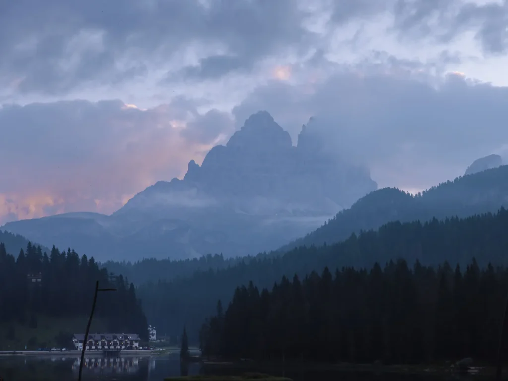
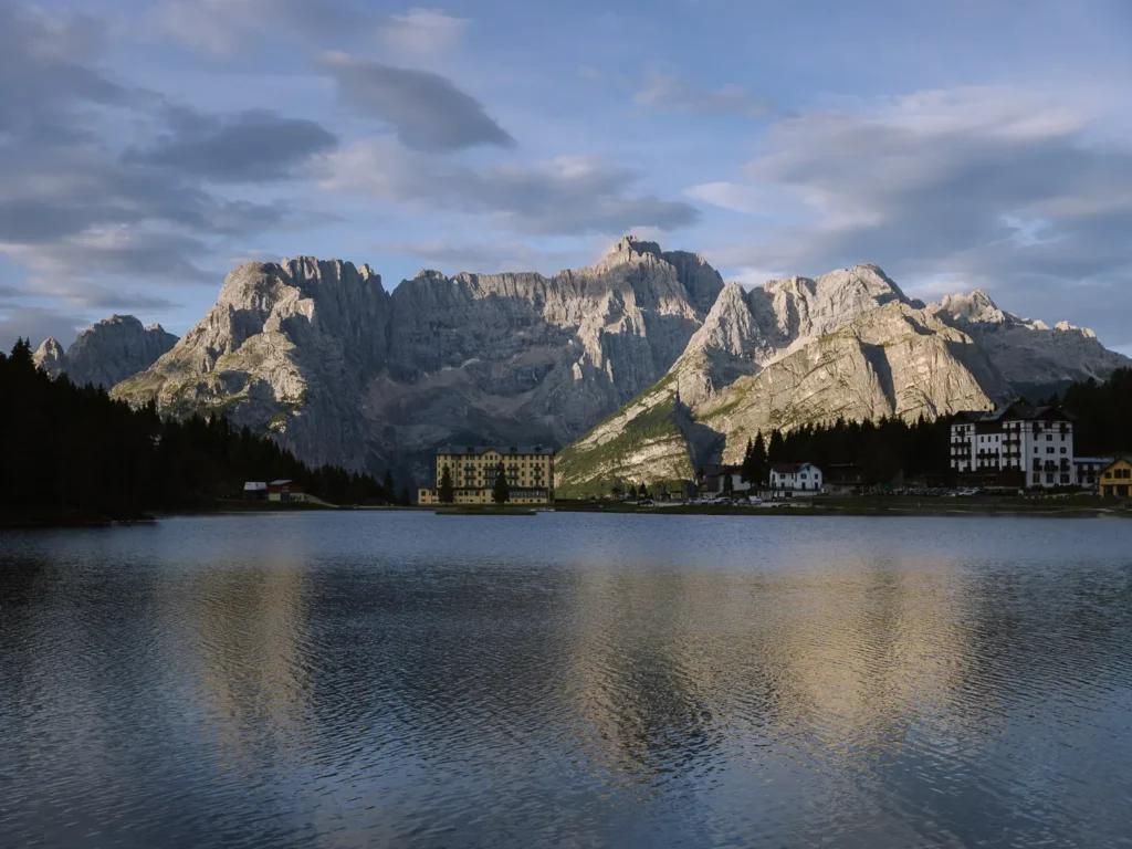
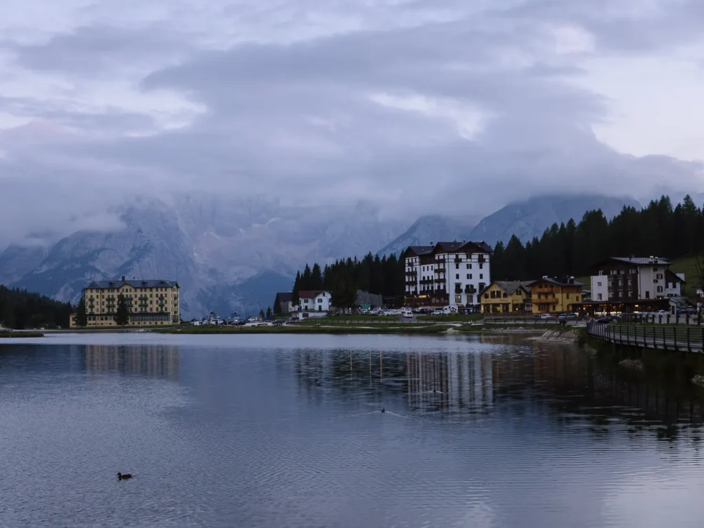
This Monte Popena hike begins at the southwestern edge of Lago di Misurina.
BY CAR
Lago di Misurina is a 30-minute drive from Cortina d’Ampezzo, Auronzo di Cadore, or Dobbiaco (Toblach in German).
There is free parking at the Col de Varda parking lot at the southern edge of Lago di Misurina, but it can fill up quickly. There is more paid parking around the edge of the lake.
Misurina can get very busy with day trippers, but the car park spaces turn over quite quickly. If you are in peak season, try to arrive early or late in the afternoon.
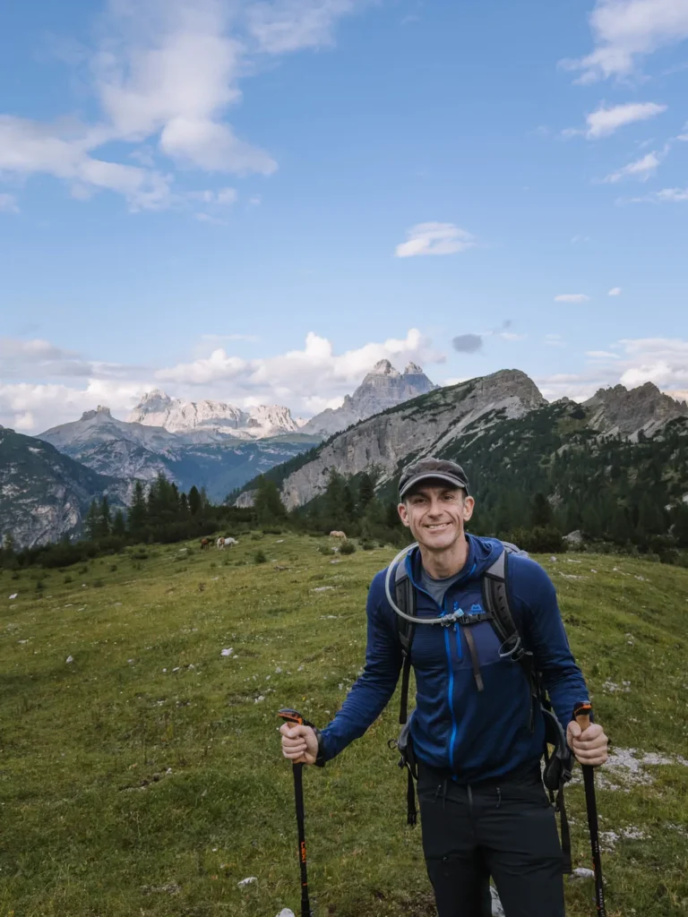
We began our hike around 4:30 PM in mid-August, when many of the day-trippers had headed home.
BY BUS
The 051 bus runs between Cortina d’Ampezzo, Passo Tre Croci, and Misurina, but it is quite infrequent. There are only three buses in the morning and three buses in the afternoon, so timing your journey is important.
The bus takes 35 minutes from Cortina and 20 minutes from Passo Tre Croci.
Get off at Misurina Col de Varda bus stop, which is very close to the start of the walk.
The 445 bus runs from Dobbiaco (Toblach) to the Misurina Genzianella bus stop, just north of Lake Misurina. The bus journey takes 30 minutes, but it is infrequent and only runs 3 times a day. From the bus stop, it is a 15-minute walk to the beginning of the trail.
HIKING INSTRUCTIONS
LAGO MISURINA TO FORCELLA POPENA (1 hour 20 minutes)
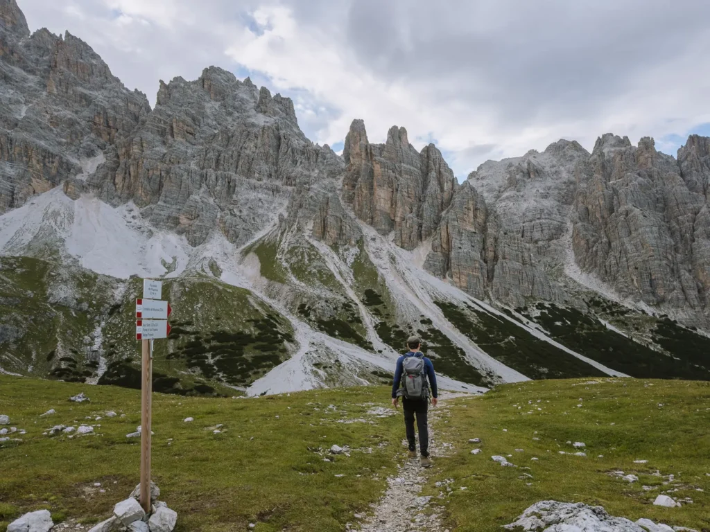
Take Path 224 signed to Pale di Misurina that runs westward from the southwestern corner of Lago di Misurina (1,754m), between Hotel Lavaredo and the Post Office.
The path steadily climbs uphill through a conifer forest, and after about 30 minutes, it reaches a junction of paths.
Turn left and take Path 224b signed to Forcella de Popena.
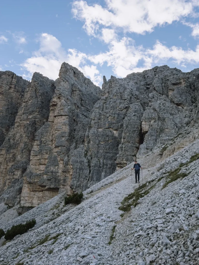
The path now rises above the trees and contours along the southwestern flank of Monte Popena.
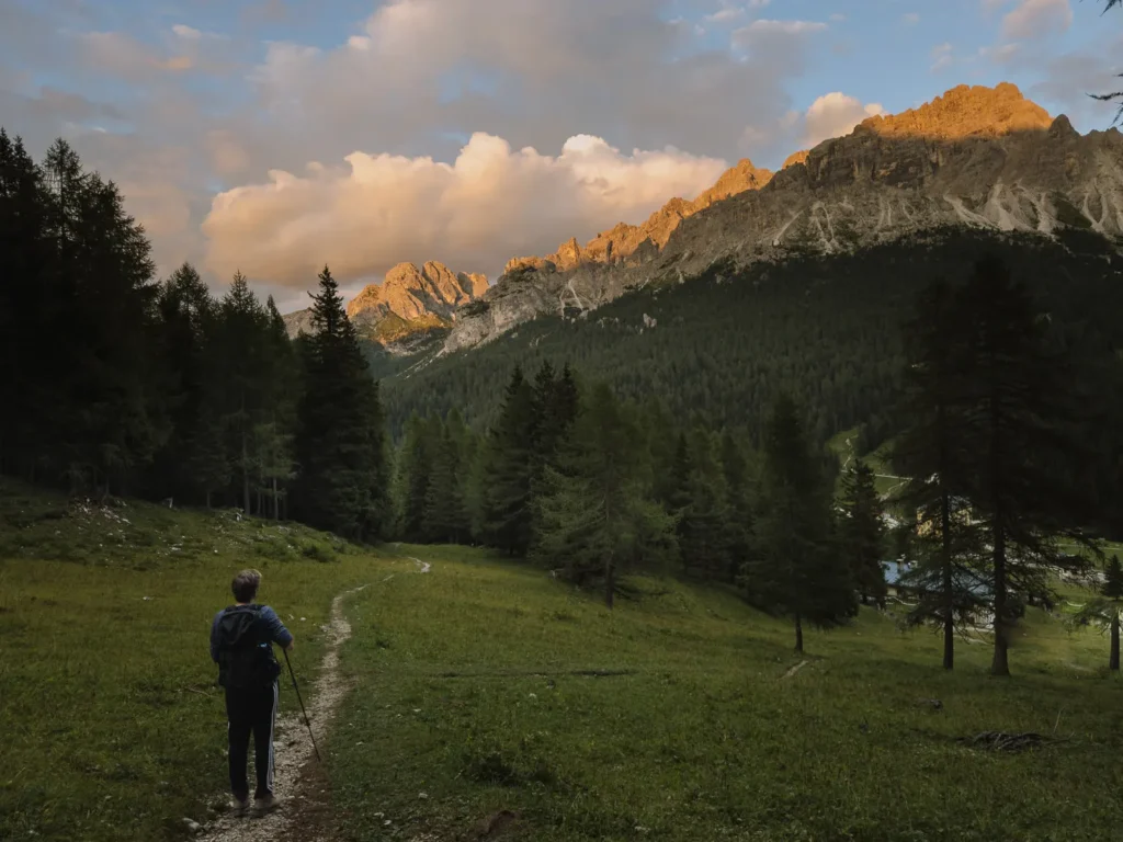
In front of you are the imposing crags of Sorapis and Marmarole. Behind is Lago Misurina, backed by the soaring pinnacles of Tre Cime and the Cadini di Misurina.
We hiked this in the late afternoon and early evening, and the gentle light on the mountains was wonderful.
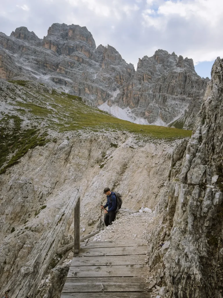
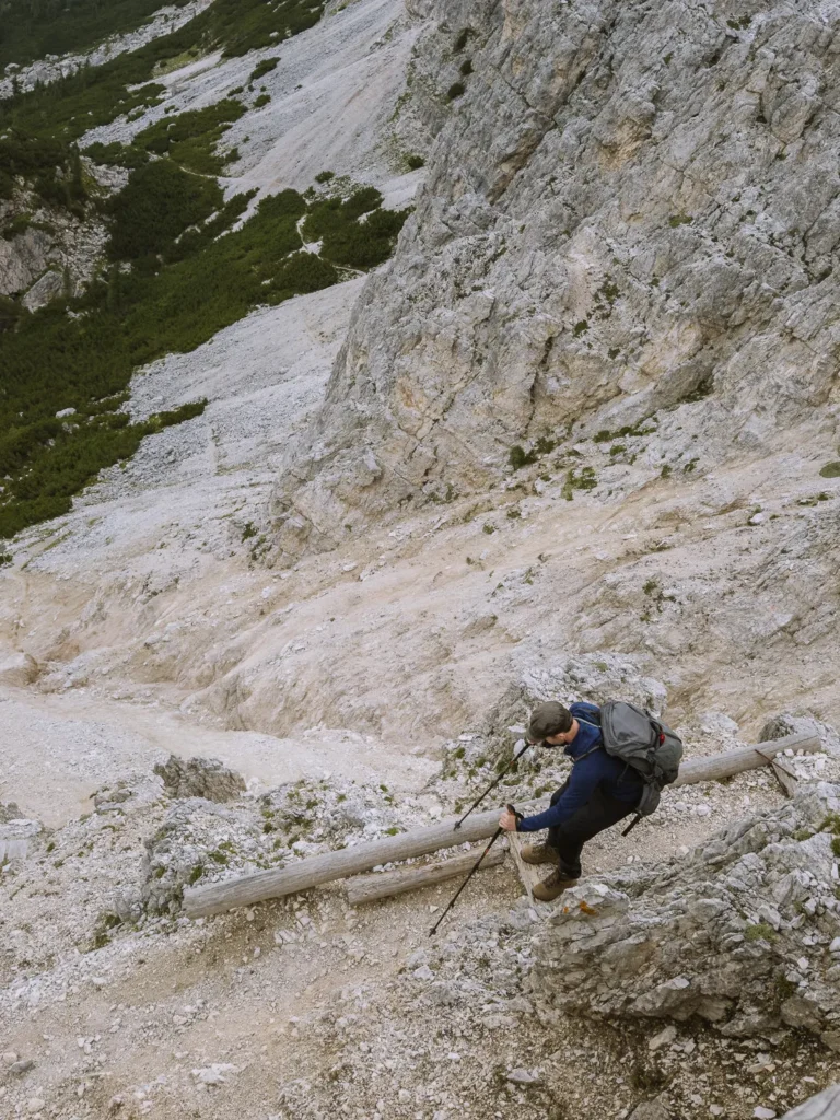
After another 30 minutes, the path turns right and zigzags steeply up a scree slope. At the top of the zigzags, it meets path 222. Turn right on path 222 and then follow it immediately left up a heavily eroded gully.
This is the most challenging part of the hike, and the only reason we have graded it medium to challenging.
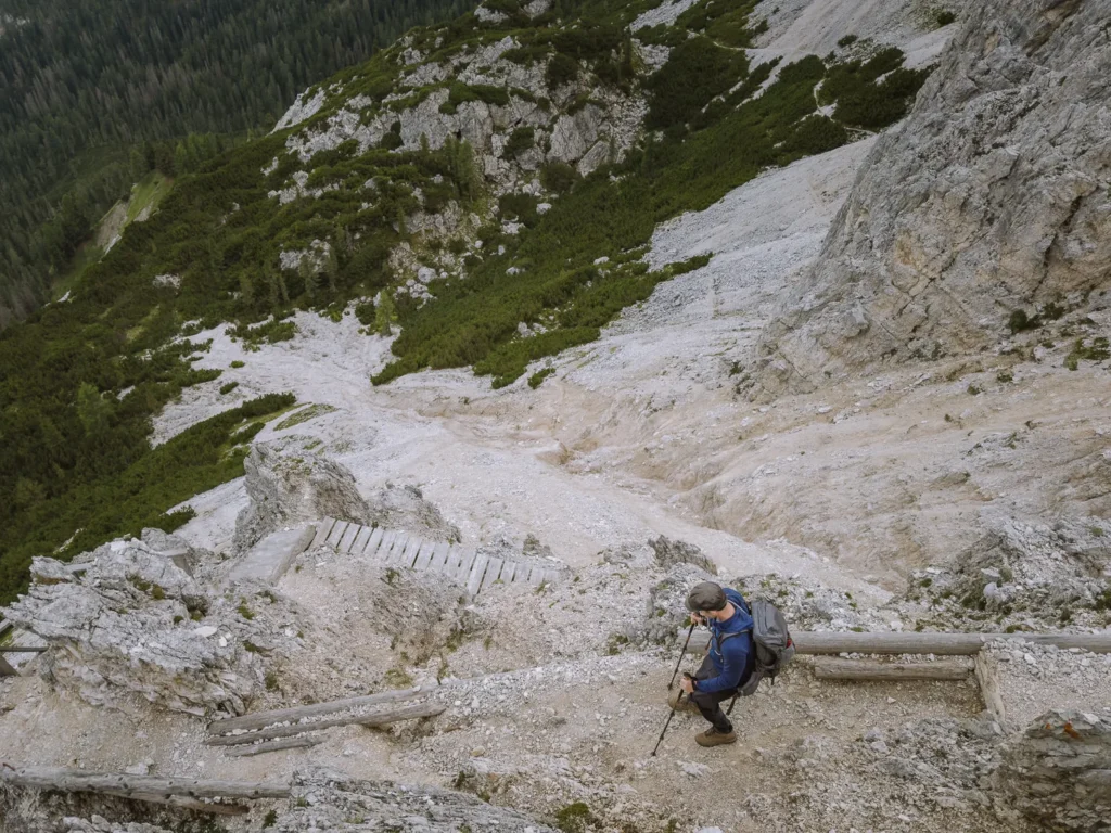
The first half of the gully is a mess of loose rock. Keep your eyes out for the red and white markers painted on the rocks and carefully ascend.
It is essential to have good grip on your shoes/boots, and your hands will be needed in places.
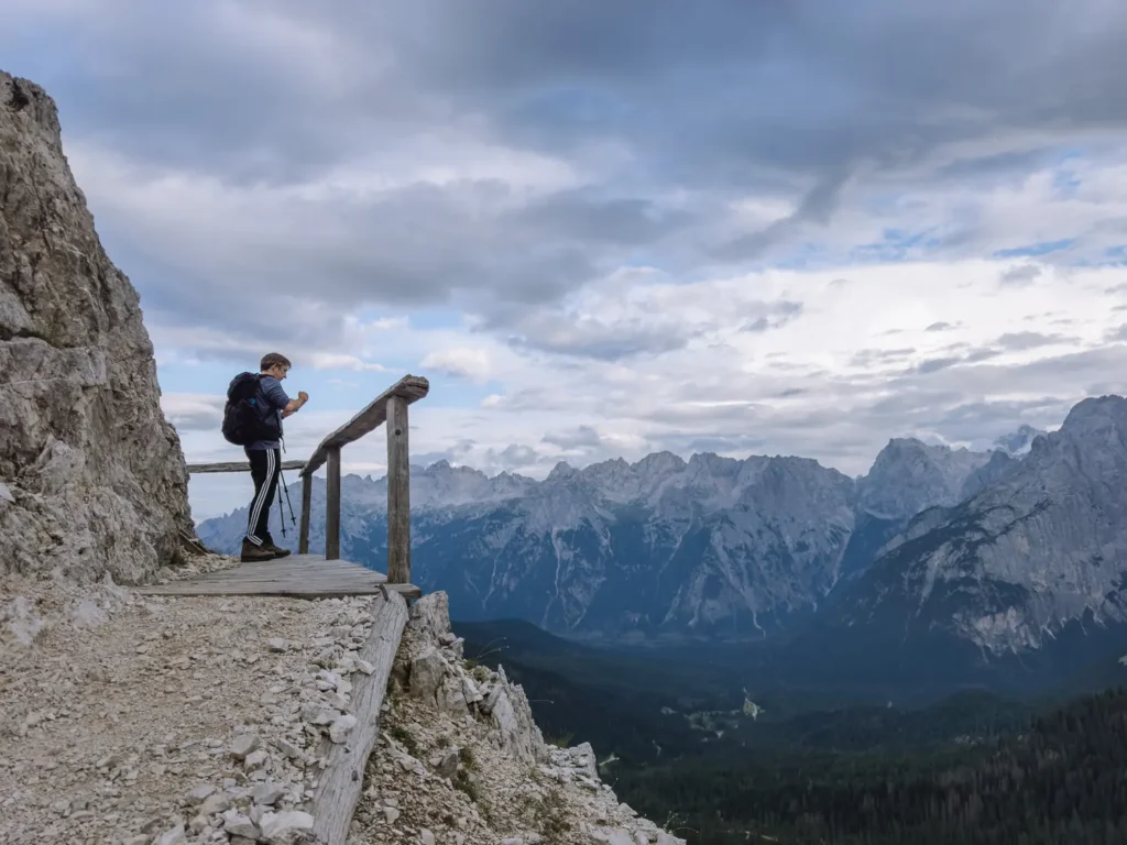
The second half of the gully is so eroded that wooden walkways and stairs have been installed to help you climb. Some have handrails and feel pretty safe, but a couple have no handrails and feel somewhat exposed.
A reasonable head for heights and careful foot placement are required.
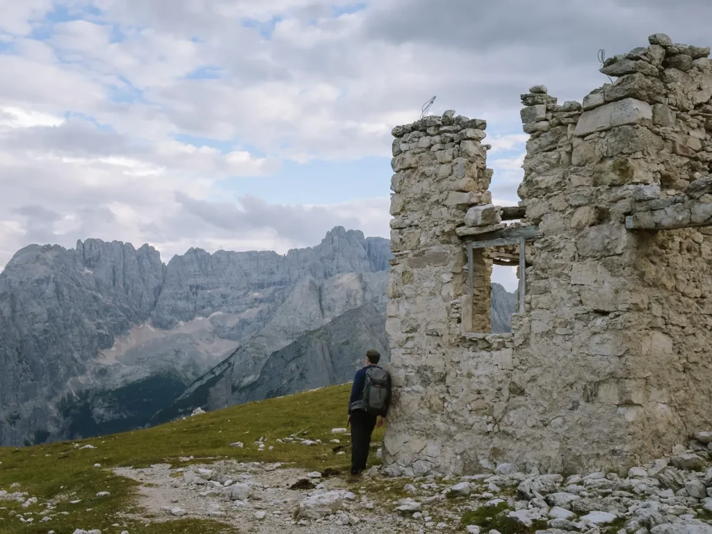
It took us about 15 minutes to negotiate the gully, after which we took a big sigh of relief and enjoyed the magnificent views from Forcella Popena (2,213m).
FORCELLA POPENA TO FORCELLA PALE DI MISURINA (50 minutes)
A ruined rifugio sits at the top of Forcella Popena, creating an interesting focal point with the Cristallo massif towering all around.
Continue on Path 222 as it heads northward and descends into the Popena Valley. The valley is remote and rarely visited by hikers.
It is a lovely, gradual descent through a rocky meadow, where horses often graze. The trail drops back into the tree line, and just before it crosses a rocky stream, you come to a junction of paths.
Turn right and take Path 224 in an easterly direction.
The trail climbs through the trees, gradually steepening, and shortly after a tight (almost hairpin) right-hand turn, it reaches Forcella Pale di Misurina (2,130m).
FORCELLA PALE DI MISURINA TO LAGO MISURINA (50 minutes)
At the pass, turn left continuing on Path 224 signed to Malga Misurina. It descends a couple of zigzags to reach the junction of paths 224 and 224b, which you were at about 2 hours ago.
Keep left and retrace your footsteps on Path 224 back to Lago di Misurina (1,754m).
We did the hike late in the afternoon so we could descend near sunset, and we got lucky. With the final light of the day, the peaks of Tre Cime turned red with the famous alpenglow of early evening.
We finished the hike with a German beer and an excellent pizza at Pizzeria Edelweiss.

RIFUGIOS ON ROUTE
Sadly, there are no rifugios on this hike, but there are a couple of good eating places at the beginning and end.
Malga Misurina – Traditionally, a ‘malga’ was a temporary farm that served meals made using ingredients like cheese, yoghurt, and milk produced on the property. Many ‘malgas’ are now simply restaurants, but this one maintains the tradition. All dairy products are produced on the farm, along with a range of grappa.
Pizza Edelweiss – This popular restaurant has pizza, pasta, and other main dishes at very reasonable prices. There’s often a queue, but tables turn over quickly. Lunch runs from 11 AM to 3 PM, and dinner runs from 7 PM until midnight. They also have an excellent selection of beers, of which we tried quite a few!

BEST TIME TO HIKE
The best time to hike the Monte Popena circuit is from early July to late September. The snow should have melted from the high ground, and the weather is at its warmest.
We hiked in mid-August, and despite it being peak season, we encountered only two other people on the walk. The Popena Valley was entirely deserted.
Being just over 3 hours long, it’s a great hike to do in the late afternoon/early evening. We timed the hike to descend just before sunset, and it was magical.
WHAT TO TAKE ON THE HIKE
Hiking Boots – The climb up to Forcella Popena requires shoes with very good grip. We use something similar to these.
Hiking Poles – We’re recent converts to hiking poles, and they are generally really helpful. We use the trusty Leki Sticks.
Waterproofs – Weather conditions on the walk can change dramatically, and rain is common in the afternoon. Make sure you take a waterproof like this one.
Sunblock/Hat – Since much of the walk is not in the shade, bring sunblock and a hat on hot days.
Lunch/Snacks – There are no refuges on the route, so you may want to bring lunch and snacks with you. There are plenty of places to eat at the end of the hike.
Water – Make sure you have plenty of water. We use one of these hydration packs, which makes it much easier to stay hydrated on the trail.
Maps – The main route is well-marked, but it’s also a good idea to have an online map with you.
Drones – Drones are permitted on this hike, and you could get some amazing shots, but we didn’t have ours with us when we did the hike.
You can support our blog by booking your trip using these resources.
MORE DOLOMITES GUIDES

ANYWHERE WE ROAM IS
READER-SUPPORTED